Cygnet Walks
On this page you can download a PDF to view on your device with details of 14 walks in & around beautiful Cygnet, view maps of the individual walks, & download all the maps as a PDF file.
A printed version of the booklet is available for a donation at the Cygnet Living History Museum and at the Old Bank.

Production of the print version of this booklet is supported by the Foundation for Rural & Regional Renewal
We are very grateful for their assistance
Downloads
Cygnet Walks Booklet

Cygnet Walks, including all maps
This PDF is a booklet of 14 walks in & around the beautiful town of Cygnet. Some are easy & short, others a bit more challenging, but all reward you with lovely outlooks & peaceful surrounds.
You can view it on your device, or print all pages or just one walk. Note that this is a larger file so be patient.
PDF · 48 MB · 33 pages
All Maps
Cygnet Walks, maps only
This PDF contains the individual maps for all 14 walks in the booklet. Use it for the physical booklet. You can also view the maps online below but you can not zoom those maps. Use this file or the full online booklet above to zoom.
PDF · 39 MB · 16 pages
Maps
Click any map to view full size
Download the PDF versions above if you want to zoom in on a map
Maps of the individual walks
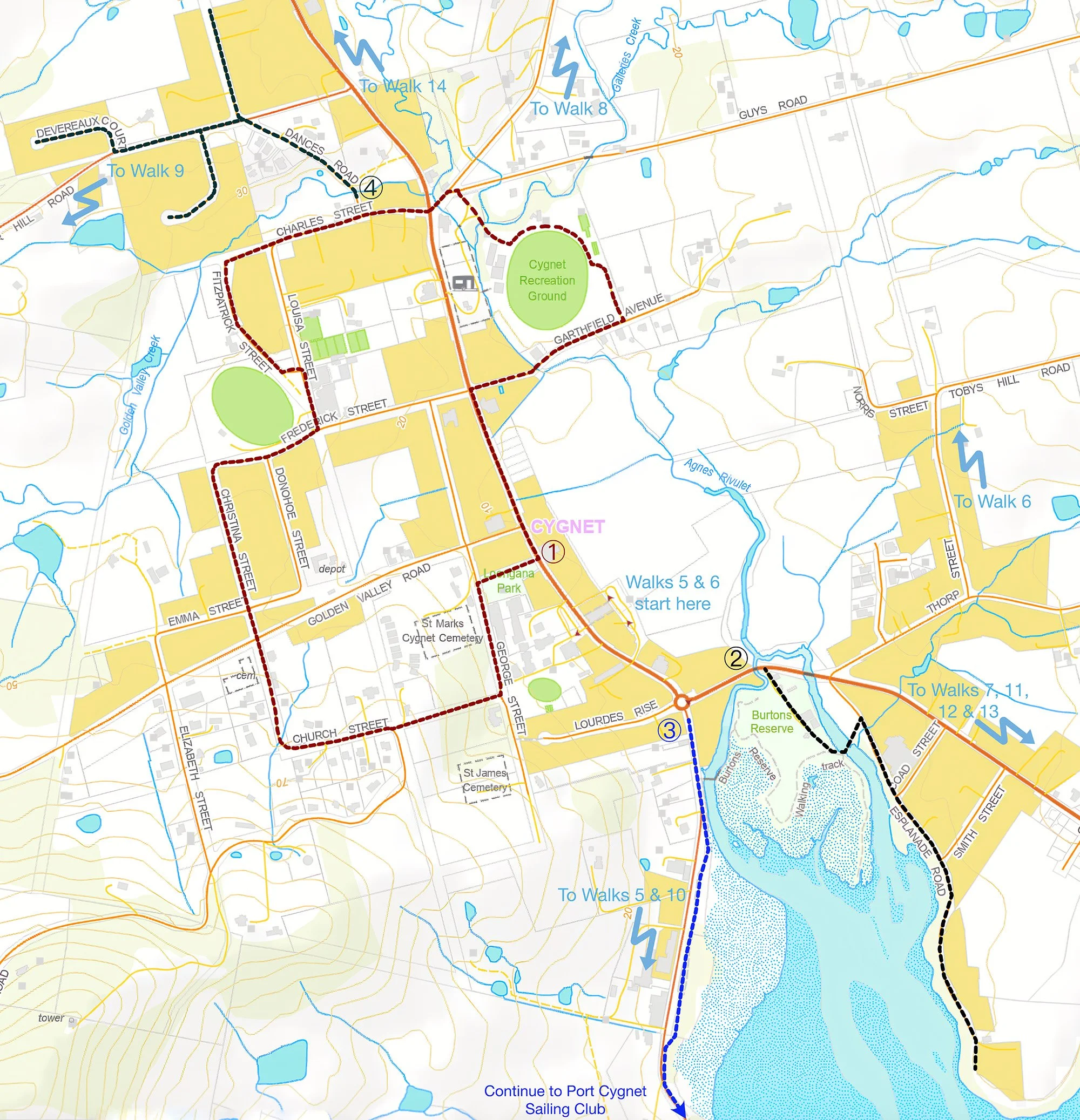
Walks 1 to 4
Walks around Cygnet town
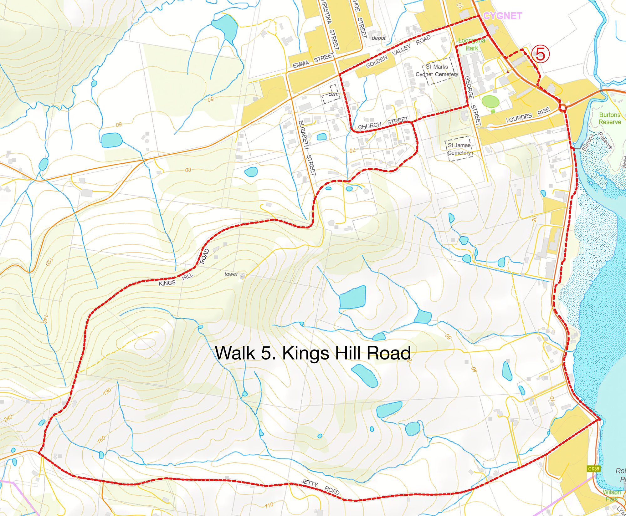
Walk 5
Kings Hill Road Loop
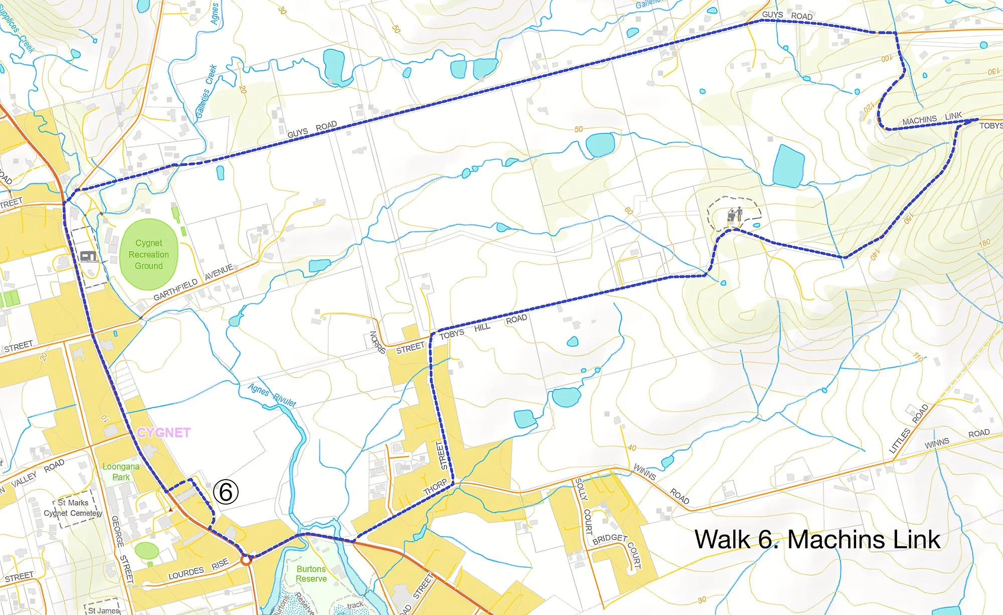
Walk 6
Machins Link
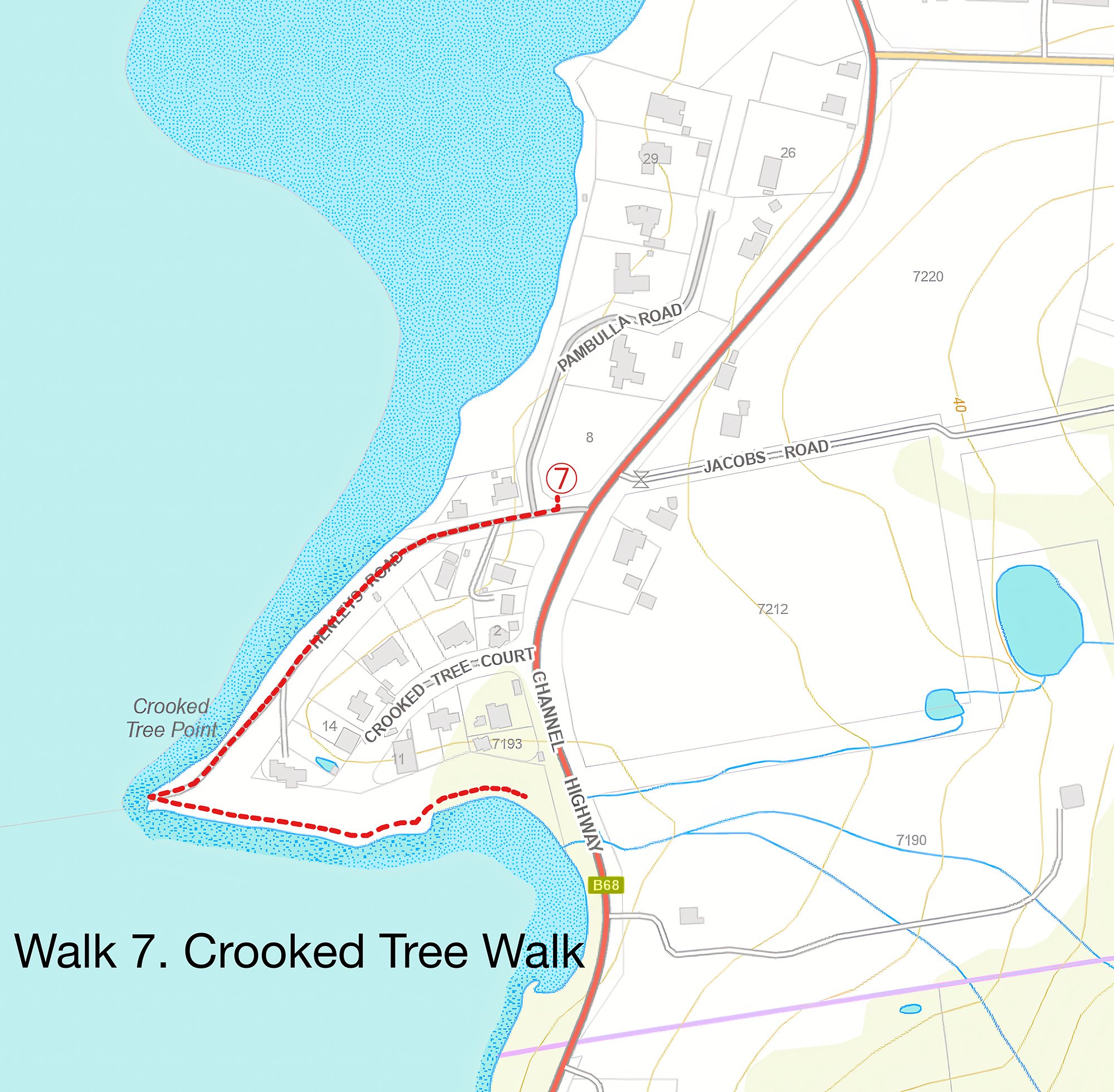
Walk 7
Crooked Tree Walk
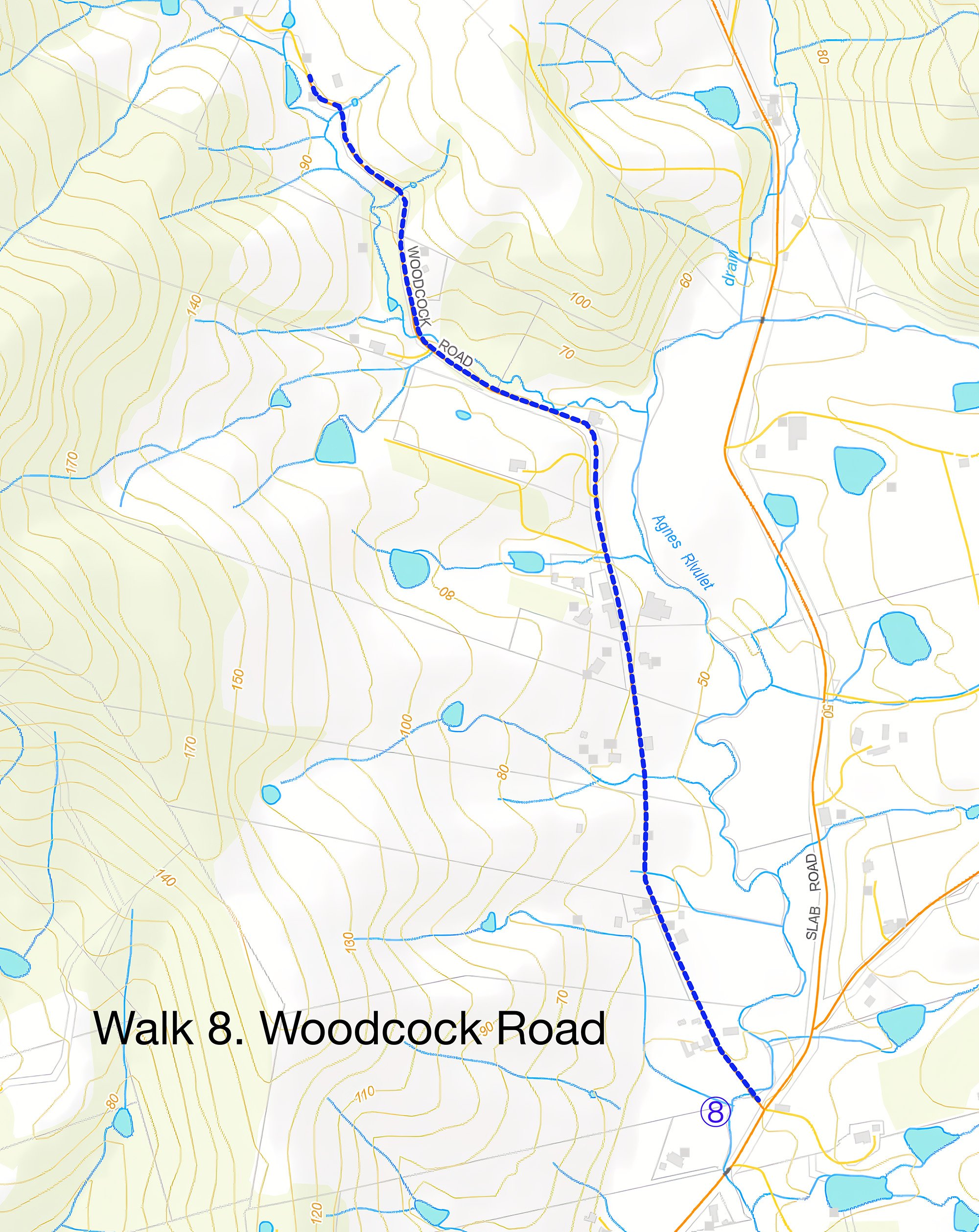
Walk 8
Woodcock Road
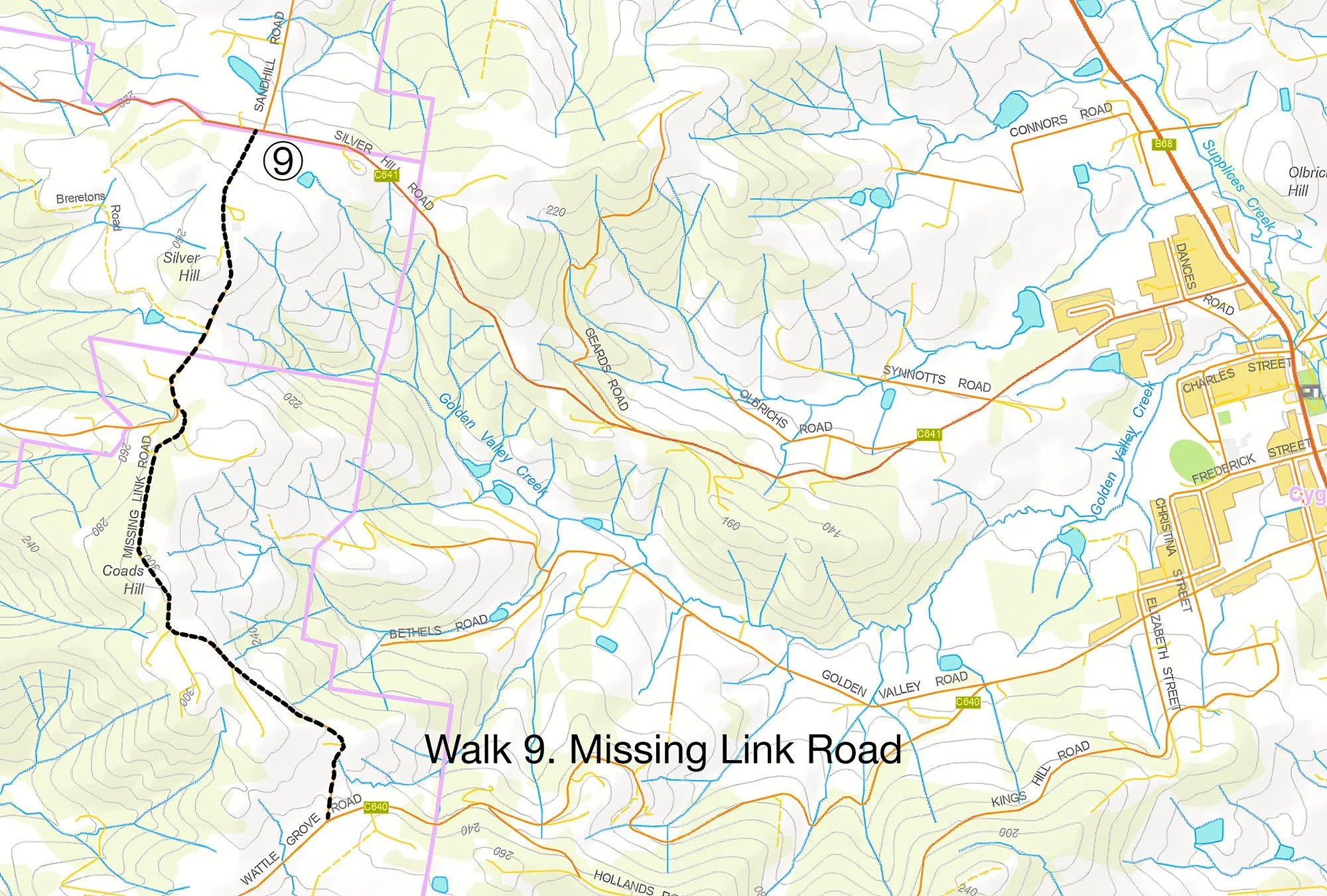
Walk 9
Missing Link Road
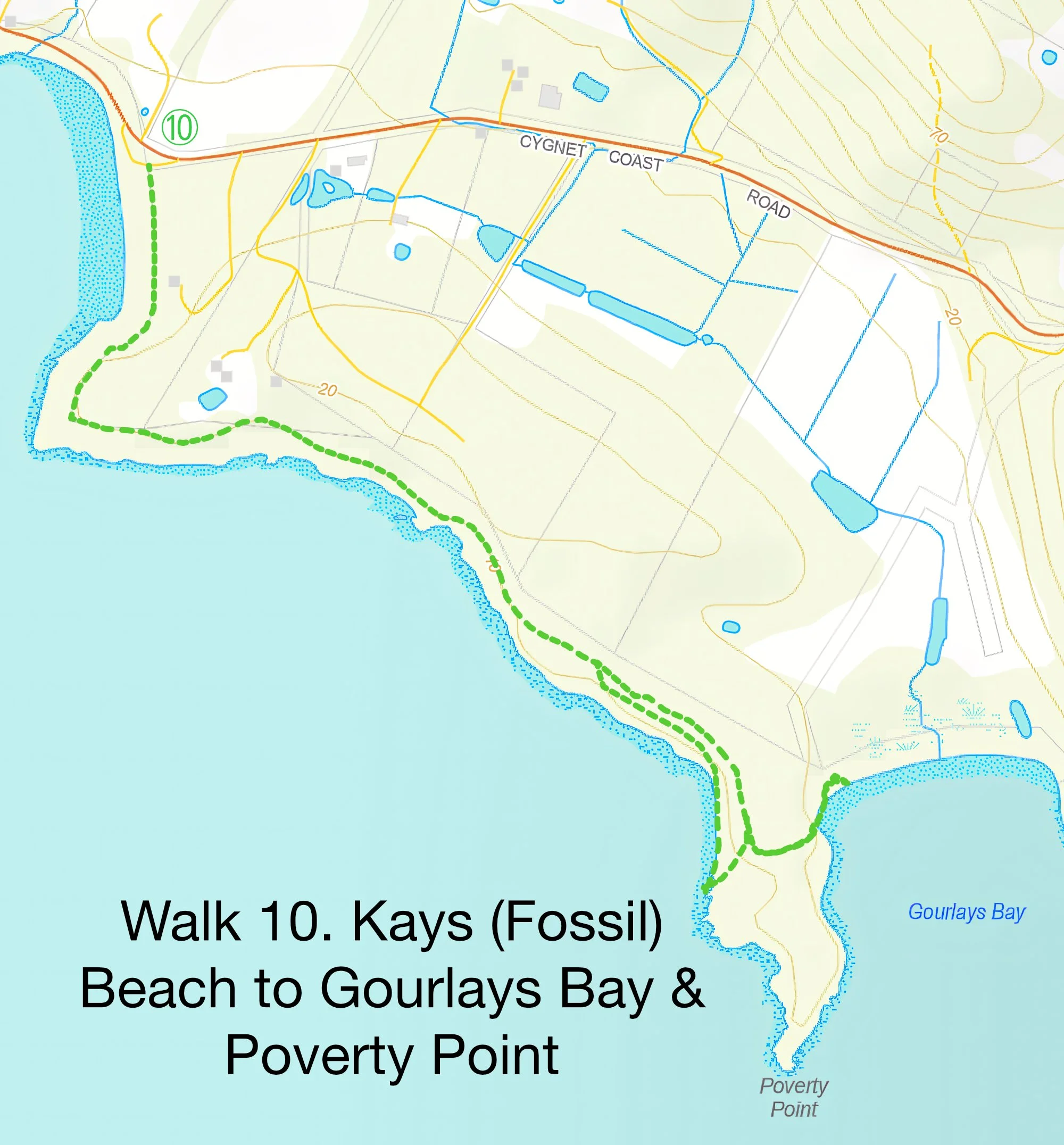
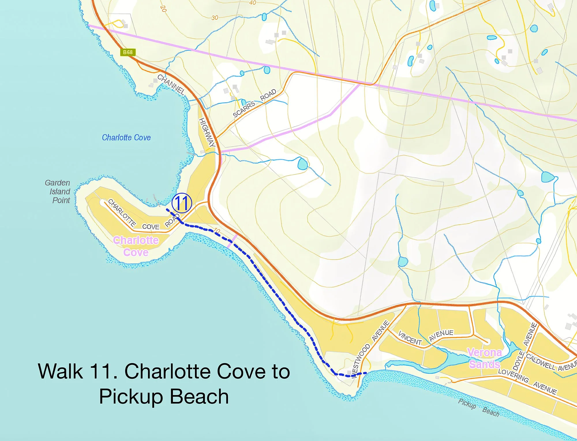
Walk 11
Charlotte Cove to Pickup Beach
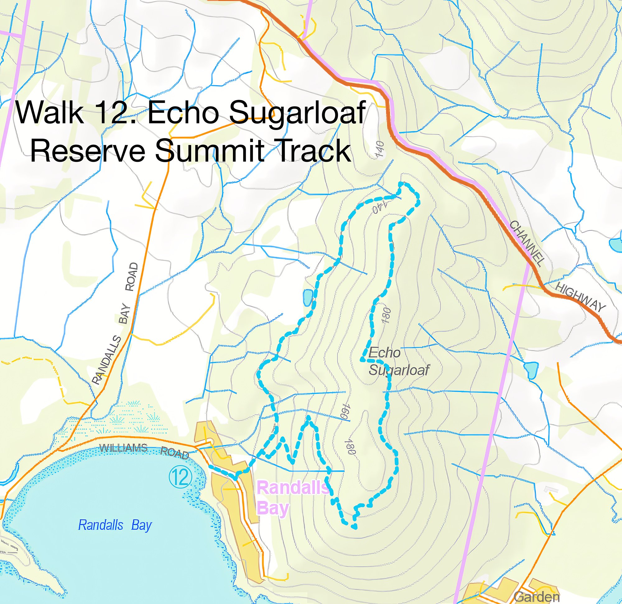
Walk 12
Echo Sugarloaf Reserve Summit Track
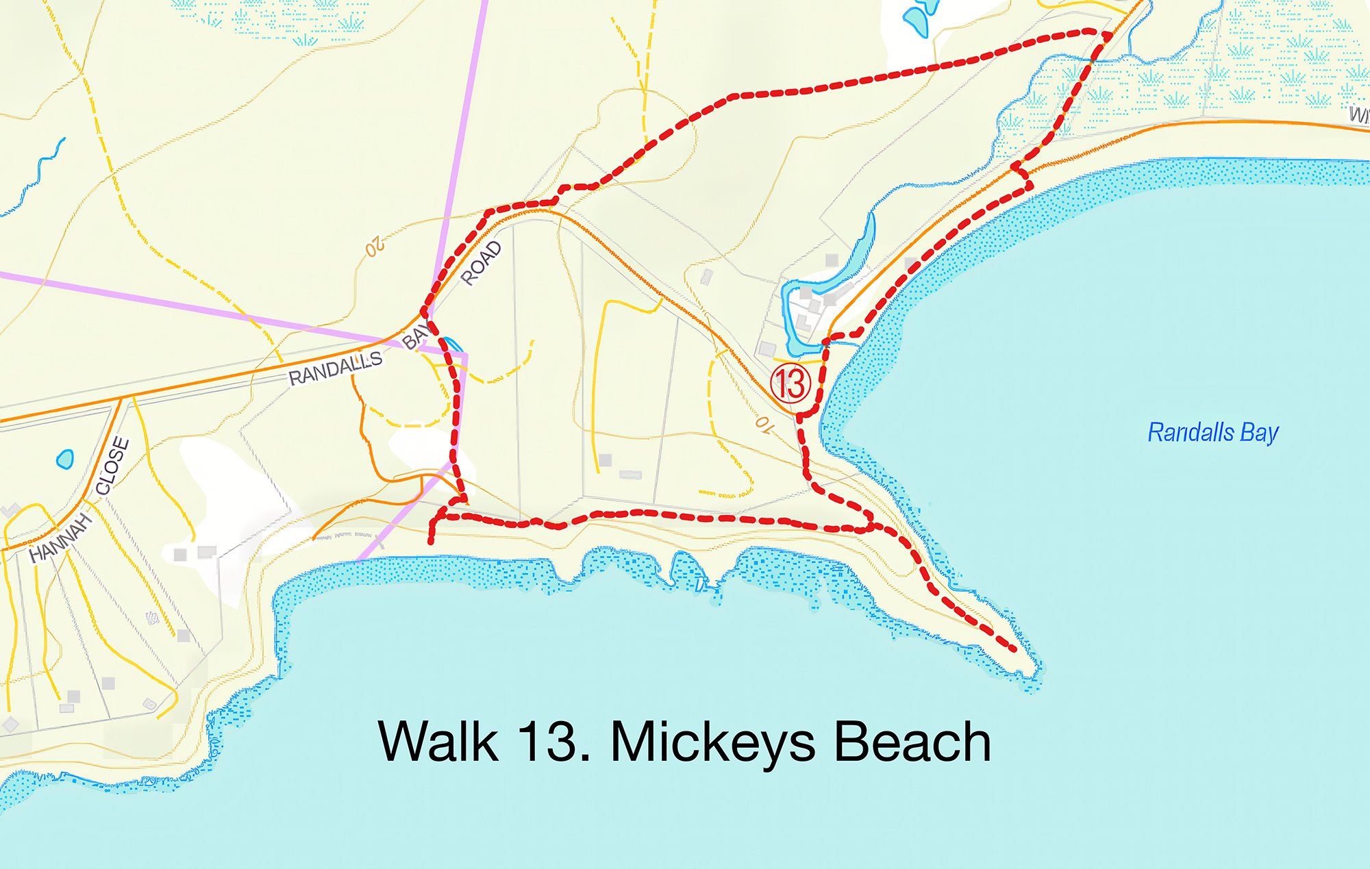
Walk 13
Mickeys Beach
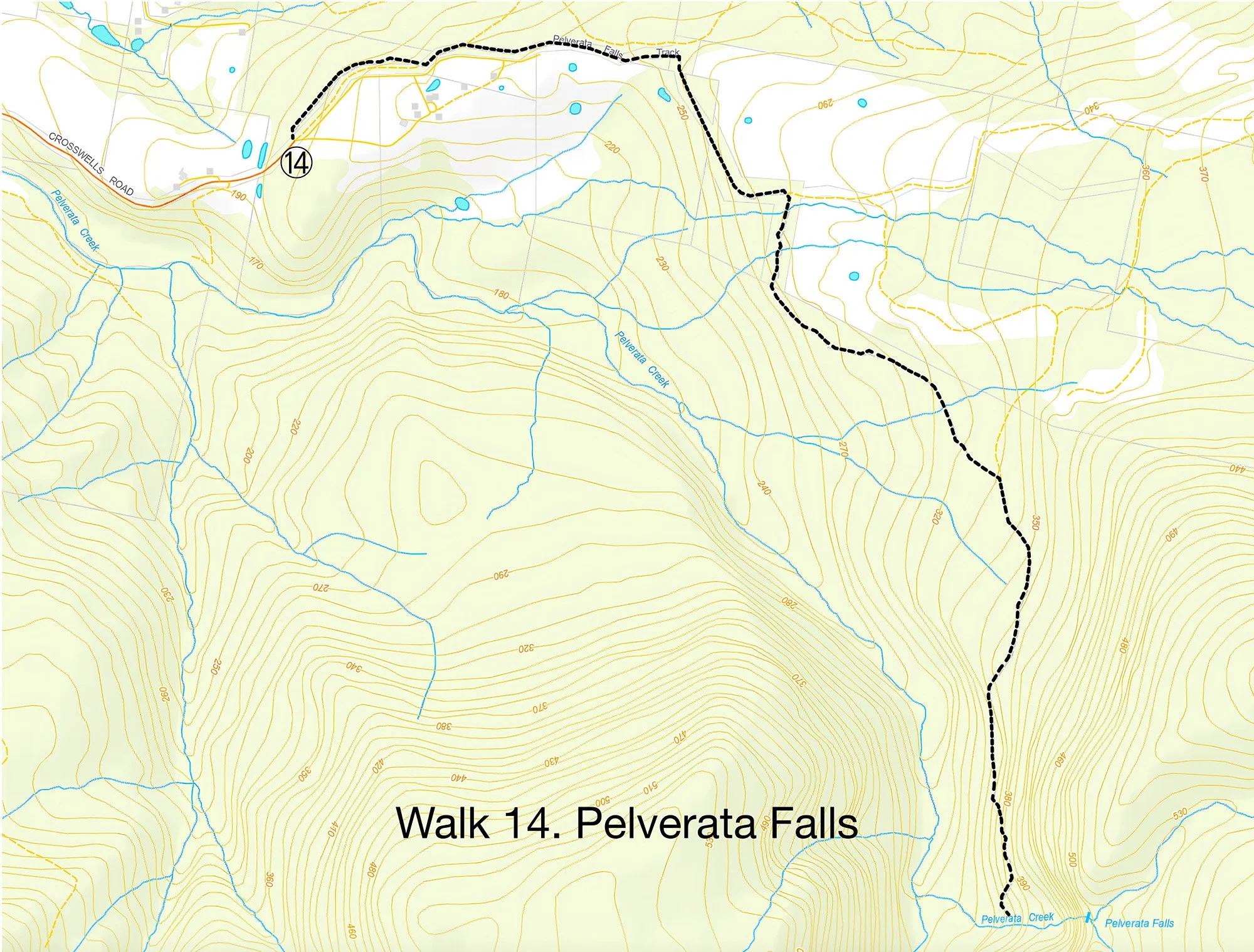
Walk 14
Pelverata Falls